
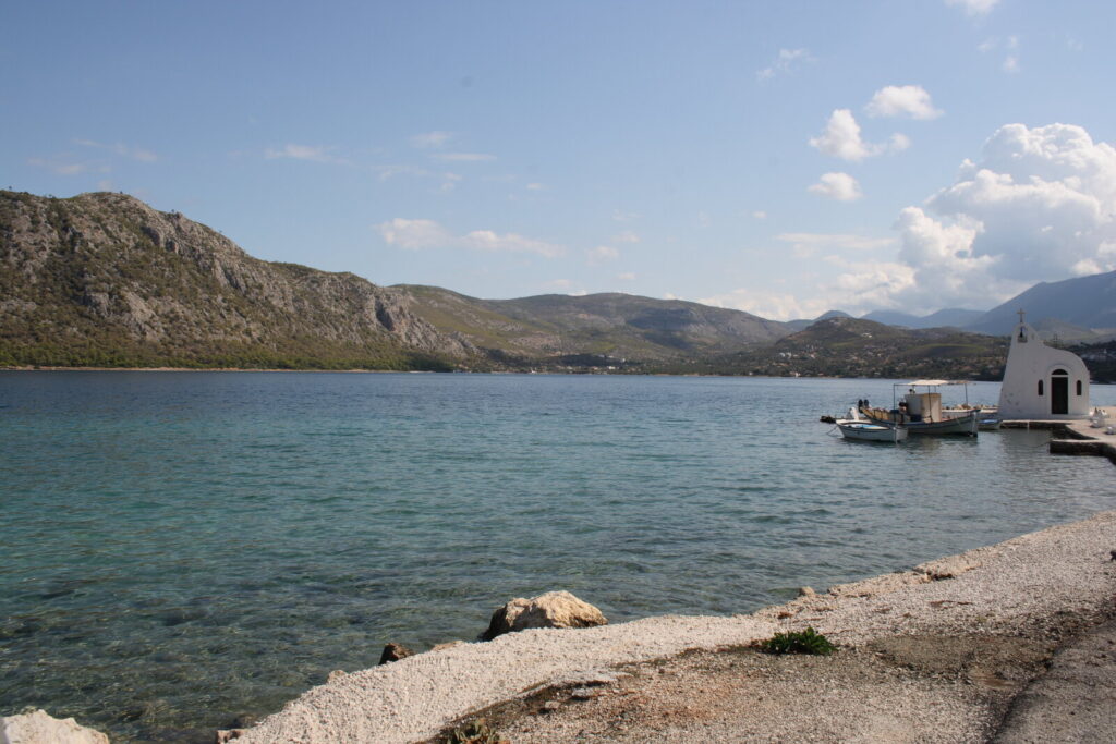
Before anything else, a warning that will save you a wasted morning. Two places in Greece are called Lake Vouliagmeni. One is a thermal spa lake in the southern suburbs of Athens, with lockers, an entrance fee and small fish that nibble your feet. The other is the one we are writing about: a sea-fed lagoon on the Perachora peninsula, roughly 16 kilometres west of Loutraki, with no gate, no staff and no facilities at all. Search engines mix them up constantly, and so do several Greek tourism sites. If a page quotes you a water temperature and an admission price, it is describing the Athens lake.
The Corinthian one is the quietest half-day we send guests on, and it comes with two more things attached to it: an ancient sanctuary of Hera at the tip of the cape, and a lighthouse from 1897 that faces the sunset. Our things to do guide gives the short version; this is the full one. If you are working through the area’s set pieces, the other one is eight kilometres the other way: the Corinth Canal.
A lagoon, not a lake
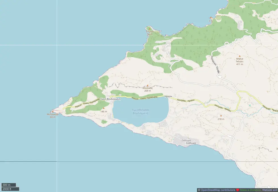
Calling it a lake undersells what is interesting about it. The basin runs about two kilometres at its longest and a kilometre at its widest, and it reaches depths of up to forty metres — deep enough that the middle stays dark while the edges go pale turquoise. It is thought to have formed when the ground subsided in antiquity.
The connection to the sea is the part worth walking over to see. A channel roughly six metres wide, cut by hand at the end of the nineteenth century, joins the lagoon to the Corinthian Gulf. Tide pushes water through it about every six hours, and because the drop into the basin is steep, the inflow behaves less like a tide than a small river, with a visible swirl where it enters. The result is water saltier than the open sea and, in autumn, noticeably warmer than it.
You can swim, and locals do, from the shingle along the road. You can snorkel, and the shallows hold small fish, molluscs and starfish. Scuba diving with tanks is not allowed. There are no lifeguards — no source we can find says the lagoon is patrolled, and nothing about the place suggests it is, so treat the water as unsupervised and keep an eye on children near the channel, where the current is real.
Two things you will read that are not true
The lagoon is often described online as UNESCO-designated. It isn’t. The designation it actually carries is Greek: a Landscape of Outstanding Natural Beauty, a national category assigned by ministerial decision, and the decision covering this stretch of the Corinthian Gulf coast dates from 1992. UNESCO has nothing to do with it. The claim appears to have been copied from site to site, including by tourism pages that ought to know better.
The second error is the Natura 2000 code. The code you will see attached to “Lake Vouliagmeni”, GR3000006, belongs to the Attica lake and the Hymettus forest around it. We could not find any Natura 2000 site that covers this lagoon itself. The nearest listed site is offshore: the Alkyonides islands, GR2530007. That does not make the peninsula unprotected, but it does mean anyone citing a Natura code for the lagoon is quoting the wrong lake again.
Small corrections, but they matter here, because the two mistakes travel together and end up in itineraries.
Gorge, and the people who got here first
In antiquity the lagoon was called Eschatiotis, and also Gorgopis, after Gorge, a daughter of Megareus who is said to have drowned in it. Whether that name came before or after the drowning is the sort of question ancient sources leave open.
The older human trace is more concrete. A settlement from the Early Helladic period — the third millennium BC — was found by an archaeologist of the British School at Athens a few metres west of the channel. People have been using this piece of shoreline for something like five thousand years, which puts the sanctuary up the road in perspective: it was a latecomer.
Around the shore
A road runs about five kilometres around the lagoon, flat enough to cycle and quiet outside August. A small chapel of Agios Nikolaos — the sailors’ saint, which tells you what the people who built it did for a living — stands by the water and is the landmark everyone photographs.
Tavernas operate along the shore, serving fish. We are not naming one, because we could not verify which are currently open to a standard we would publish, and a recommendation for a closed taverna is worse than none. Ask us the week you arrive and we will tell you what is actually serving. There is no accommodation at the lagoon itself; people who want to stay in the area stay in Loutraki or rent a house nearby.
The Heraion of Perachora
Two kilometres further west, where the peninsula narrows to a rocky point, is a small cove holding the sanctuary of Hera Akraia. Cult activity here appears to run from perhaps the ninth century BC until 146 BC, when Mummius sacked Corinth and the sanctuary was abandoned; Roman houses were later built over the ruins.
What survives rewards a slow walk rather than a quick photograph. The earliest structure was an apsidal building — hairpin-shaped in plan — dated to around 820 BC. A Doric temple of Hera Akraia followed around 550 BC, slightly west of it, with a cella unusually divided into three aisles. Late in the fourth century BC an L-shaped stoa went up on two storeys, Doric below and Ionic above: the first known building anywhere to combine the two orders that way, which is the detail most visitors walk past without noticing.
Then there is the water infrastructure, which is genuinely impressive for the fifth century BC. A double-apsidal cistern of about 420 BC runs roughly six by twenty-one metres with internal piers to carry its roof. East of the sanctuary sits a six-columned fountain house and a set of rock-cut cisterns reached by a fifty-metre stairway.
One correction while we are here: guides sometimes describe a “hexagonal cistern” at the Heraion. There isn’t one. The cistern is double-apsidal, meaning rounded at both ends, and the six-columned structure nearby is a fountain house, not a cistern. The two seem to have been merged somewhere along the chain of copied descriptions.
The site was excavated between 1930 and 1933 by Humfry Payne, then director of the British School at Athens, with later seasons under T. J. Dunbabin in 1938–39 and R. A. Tomlinson in 1964–65. The results were published as Perachora: The Sanctuaries of Hera Akraia and Limenia, volume one in 1940 and volume two, completed after Payne’s death, in 1962. If you want to know what came out of the ground here, those are the books.
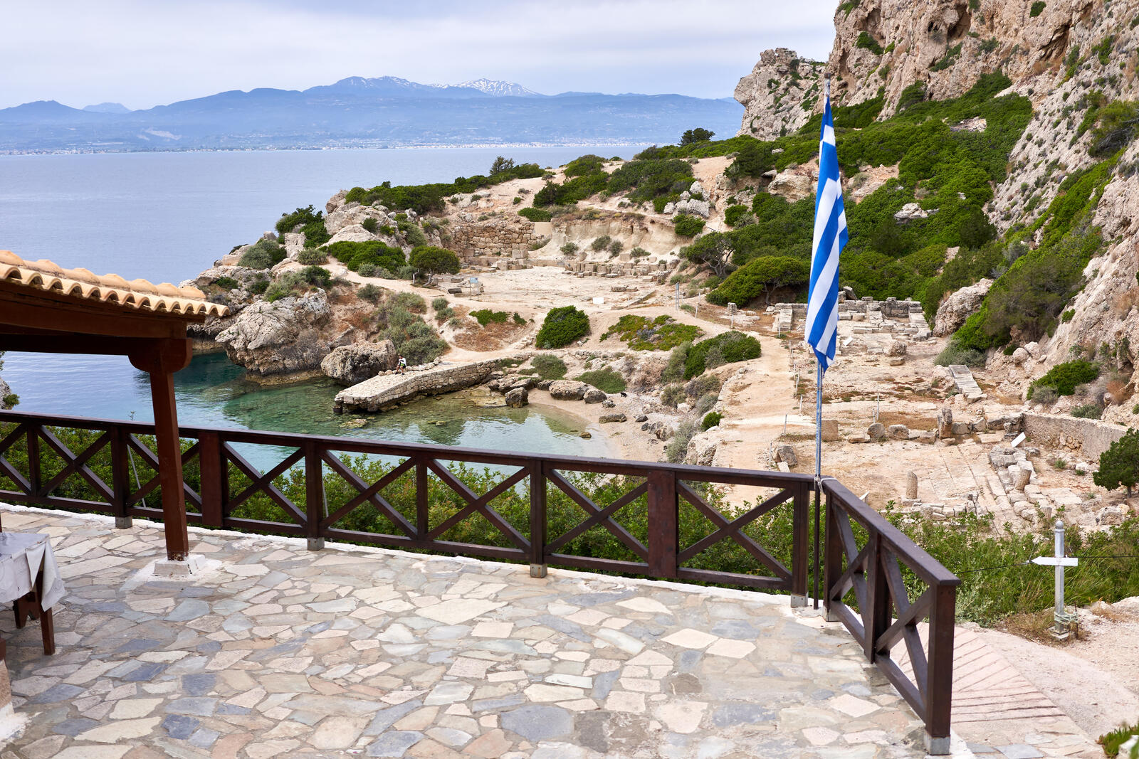
Practicalities are simple, in the way that unstaffed sites are. The Ministry of Culture’s own listing records the Heraion as free entry with free access, closed only on 25 March. So there is no ticket booth, no timetable and no shade, and nowhere to buy water. The car park is small — a dozen or so spaces in practice — and fills on August weekends. Bring more water than you think you need and sturdier shoes than sandals.
The Melagavi lighthouse
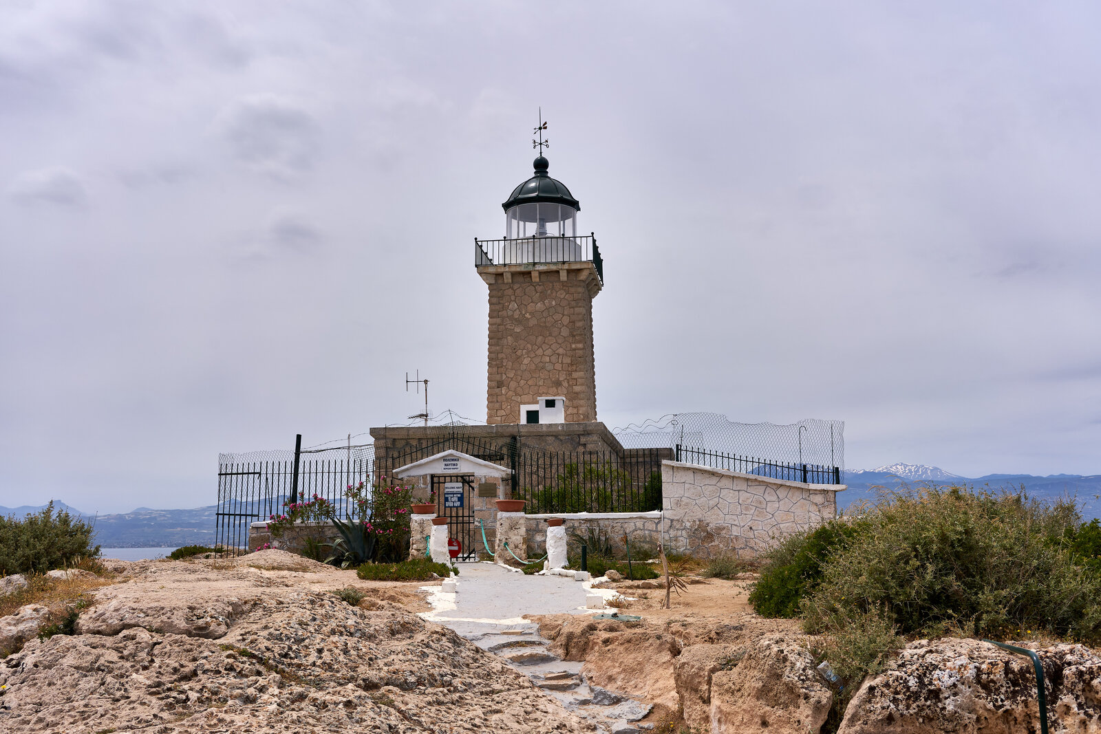
From the Heraion car park a rocky dirt path climbs to the lighthouse at the westernmost point of the cape. It was built in 1897, stands about thirteen metres tall with its light around fifty-eight metres above the sea, and is stone-built in a T-shaped plan. It went dark during the Second World War, was reactivated in 1947, converted to electric operation in 1982, and has been a listed historic monument since 2001. Like the rest of the Greek network, it belongs to the Hellenic Navy’s lighthouse service.
You cannot normally go inside. Visitors report getting as far as the gate, and the interior seems to open only on occasional public days such as International Lighthouse Day. The point of the walk is the position: the tower sits at roughly 38.028° N, 22.850° E, facing west down the Corinthian Gulf toward the mountains, which is why the last hour of daylight is the hour to be there.
Two honest cautions. The path is rock and loose stone, not a promenade, and there is no railing at the edge — it is not a walk for anyone unsteady, and it is a poor idea in flip-flops. And if you stay for the sunset, you will be driving back along an unlit peninsula road afterwards.
The coves west of the lagoon
The northern shore of the peninsula, sometimes called the Alkyonides coast, is a chain of small bays. Running along it they are Pisia, Perachora, Sterna, Mylokopi, small Mylokopi, Skalosia, Spilia tis Fokias — the Seal’s Cave — and Mikra Strava.
Two are worth singling out. Mylokopi has real shade, pines growing down to the water, and a long history of informal camping. Skalosia is a big pebble bay backed by pine woodland where the mountain runs into the sea, and it is empty most of the time for a straightforward reason: the last six kilometres of road to Mylokopi is a rough unpaved track that in practice wants a high-clearance vehicle, or about a thirty-minute walk in.
Neither has a shop, a kiosk or a tap. If you go, take water, food, a bin bag and shoes you can walk on stones in. If that sounds like too much work, our guide to Loutraki’s beaches covers the organised, Blue Flag end of the spectrum, where somebody else has brought the sunbeds.
Planning it from Loutraki
The lagoon is about sixteen kilometres from Loutraki by road, west through Perachora village. We are giving that as a distance rather than a drive time on purpose: the routing figures circulating online for “Loutraki to Lake Vouliagmeni” are frequently calculated to the Athens lake instead, which is how a twenty-minute drive turns into an hour and a half on somebody’s itinerary.
KTEL Korinthias runs a scheduled Loutraki–Perachora bus, but Perachora is the village, not the lagoon, and we have found no service that reaches the lake, the Heraion or the lighthouse. In practice this is a car or taxi trip. Coming from Athens first? Our Athens to Loutraki guide handles that leg, tolls included.
The sequence that works: lagoon and a swim in the morning, lunch by the water, the Heraion in the late afternoon when the stone stops radiating heat, then the lighthouse path for the last of the light. That is a full day at a slow pace and about four hours if you hurry it, though hurrying rather defeats the purpose of the quietest corner of the area.
What we have not told you
A few things we deliberately left out rather than guess: the names of currently open tavernas, whether mobile coverage holds along the peninsula road, and any water temperature figure for the lagoon. Numbers for all three exist online. They are either about the wrong lake or unattributed, and we would rather answer them from the desk than publish them.
Base yourself in Loutraki
The peninsula is close enough to visit on a whim, which is the argument for staying nearby rather than day-tripping from Athens. The hilltop Villa Elena, with pool and lit tennis court, suits groups large enough for a wedding or a reunion; the beachfront Villa Aura sits on the seafront at Skaloma, a short drive from the Perachora road. Send an enquiry and our concierge can plan the day around the light.
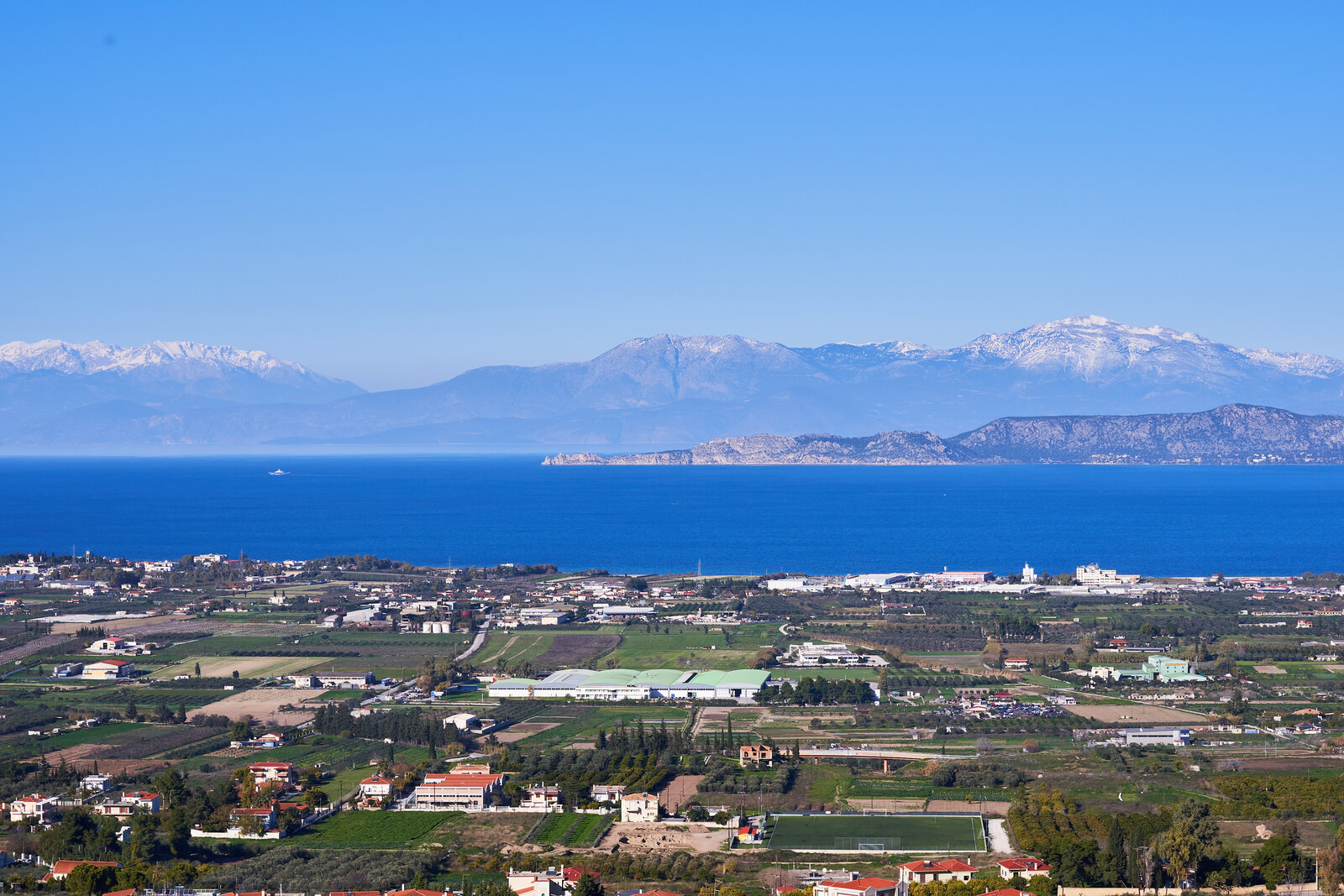
Cover photograph: “Vouliagmeni, Corinth” by Charski A.V., public domain, via Wikimedia Commons. Site status and entry conditions for the Heraion were taken from the Greek Ministry of Culture’s own listing and checked on 29 August 2026. Lagoon dimensions, the lighthouse’s history and the cove sequence come from Greek regional and municipal sources; the Natura 2000 and designation points were checked against the national protected-areas register. Anything we could not verify has been left out and flagged above.
Frequently asked questions
Which Lake Vouliagmeni is near Loutraki?
The Corinthian one, a sea-fed lagoon on the Perachora peninsula about 16 km west of Loutraki, next to the Heraion archaeological site. It is not the thermal Lake Vouliagmeni in the Athens suburb of the same name, which has an entrance fee, a spa operator and lifeguards. Water temperatures and ticket prices you find online almost always refer to the Athens lake.
Can you swim in Lake Vouliagmeni near Perachora?
Yes. The lagoon is brackish, saltier than the open sea, and warm enough for swimming late into autumn, and snorkelling is allowed. Scuba diving with tanks is prohibited. There are no lifeguards, no showers and no marked swimming area, so treat it as an unsupervised natural site and be careful near the narrow channel, where the tidal current is strong.
Is the Heraion of Perachora free to enter?
Yes. The Greek Ministry of Culture lists the archaeological site of Heraion, Perachora as free entry with free access, closed only on 25 March. There is no ticket booth, no fixed timetable and no shade or drinking water on site, and the car park holds only about a dozen cars.
Can you go inside the Melagavi lighthouse?
Not normally. The lighthouse, built in 1897 and a listed monument since 2001, is operated by the Hellenic Navy’s lighthouse service, and visitors report being able to walk up to the gate but no further. It has opened to the public on occasional days such as International Lighthouse Day. The walk up from the Heraion car park is on a rocky dirt path and is best done in the hour before sunset.
Is Lake Vouliagmeni a UNESCO site?
No. The area holds a Greek national designation as a Landscape of Outstanding Natural Beauty, granted for this stretch of the Corinthian Gulf coast by a 1992 ministerial decision, and it is regularly and wrongly described online as a UNESCO designation. No Natura 2000 site covers the lagoon itself either; the code GR3000006 often quoted for it belongs to the Attica lake, while the nearest Natura 2000 site here is the offshore Alkyonides islands, GR2530007.
