
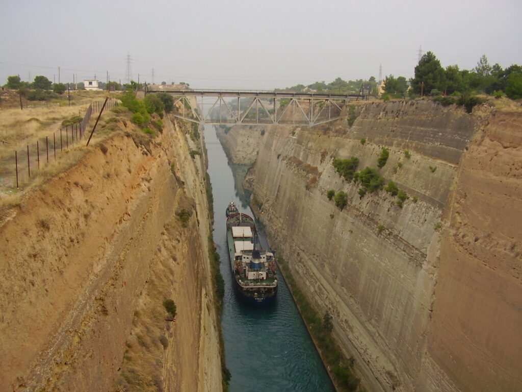
The Corinth Canal sits about eight kilometres from Loutraki, which makes it the closest famous thing to our front door and the one guests ask about most. It is also the one most travel pages get wrong, because the canal has spent much of the last five years shut to shipping and the internet has not caught up. It reopened to navigation on 17 June 2026, according to the canal authority’s own announcement. If you are planning a visit this season, that single date changes what you will actually see from the bridge.
What follows is a canal-only guide: the engineering, the two bridges that sink into the water, the ancient trackway that did the job for 1,500 years before the canal existed, and the practical business of getting there from Loutraki. For the wider area, our Loutraki travel guide and our round-up of things to do nearby cover the rest; for the quieter half-day in the other direction, see Lake Vouliagmeni and the Perachora peninsula.
Is the canal open right now?
Two different questions hide inside that one, and mixing them up is where most people go wrong.
The first is whether ships are transiting. That has been an on-and-off story since a landslide on 15 January 2021 closed the canal, and the authority’s own press release that month admitted the closure would run “longer than our initial estimate”. What followed was a run of partial seasons: open 1 June to 2 October 2023, open from 1 May 2024, open 8 March to 2 November 2025, then closed again for the final phase of slope stabilisation. The most recent notice on AEDIK’s news page, dated 17 June 2026, says the canal “is now open to navigation” after “the completion of the main phase of the critical slope stabilization interventions”.
The second question is whether you can see the canal, and the answer there has always been yes. The viewpoints, the bungee platform and the walk along the Diolkos never depended on shipping traffic. What a closure changes is your odds of watching a vessel squeeze through, which is the part most visitors actually come for.
Because that status has moved several times in five years, we’re not going to promise it will hold. Check the authority’s news page the week you travel. It is in English, it is the operator itself rather than a travel aggregator, and it is the only source that has been consistently right.
The numbers, and why the canal feels narrower than it looks in photographs
AEDIK’s own specifications page gives the cut as 6,343 metres long, 24.60 metres wide at the water surface, 21 metres wide at the bottom and 8 metres deep along its axis, with 52 metres of clearance under the bridges. The isthmus it slices through rises to 79 metres at its highest point. There are no locks: the canal is simply a trench dug down to sea level, which is why the two seas at either end share the same water level and nothing needs to be pumped.
Worth knowing before you quote those figures to anyone: AEDIK’s two English pages do not quite agree with each other. The specifications sheet says 21.00 metres at the bottom and 8.00 metres deep; the general page about the canal says 21.3 metres and “between 7.50 and 8 m”. The difference is rounding rather than dispute, and we have used the specification sheet’s numbers because that is what it is for.
Set the width against the traffic and the drama makes sense. A 24-metre channel with a 21-metre floor cannot take a modern container ship, so the vessels that do transit are small coasters, yachts and cruise ships built narrow enough to fit, usually under tow. AEDIK puts annual traffic at about 15,000 ships from at least 50 nationalities, and the shortcut saves roughly 700 kilometres against sailing around the Peloponnese. That is the canal’s entire commercial argument in one sentence.
The free viewpoint on the old road bridge
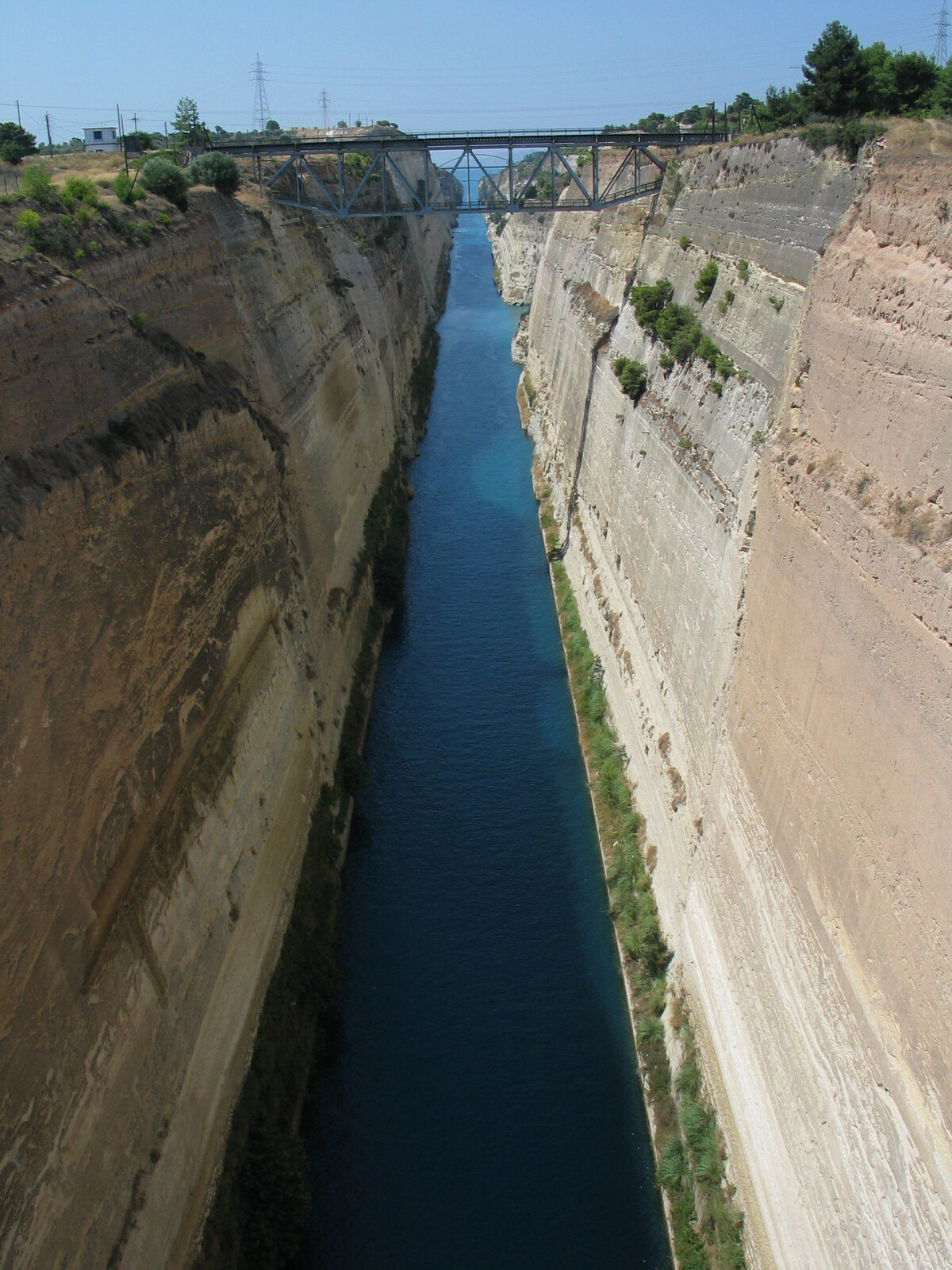
The classic view is from the old Athens–Corinth national road bridge, right by the Loutraki interchange. There is no ticket, no gate and no opening time. You park at the roadside, walk out onto the footway and look straight down a slot in the rock at water the colour of bottle glass. Cafés and souvenir stalls sit at both ends; several travel guides describe the parking as free, and that matches what our guests report, though we have not found an official source that states it, so treat it as likely rather than certain.
The same bridge carries the bungee platform run by Zulu Bungy, which has operated at the canal since 2002. We cover the jump in our things to do guide, and two cautions from that piece still stand. The operator does not publish the height of the drop, so any exact figure you see elsewhere is somebody’s estimate. And the newest price list we can actually read — the operator’s own site currently blocks automated requests, so we are relying on an archived copy from November 2024 — gives €100 for a jump with GoPro footage and €130 with a drone added. Prices may have moved since. Ask them directly before you plan a day around it.
The bridges that sink: Isthmia and Posidonia
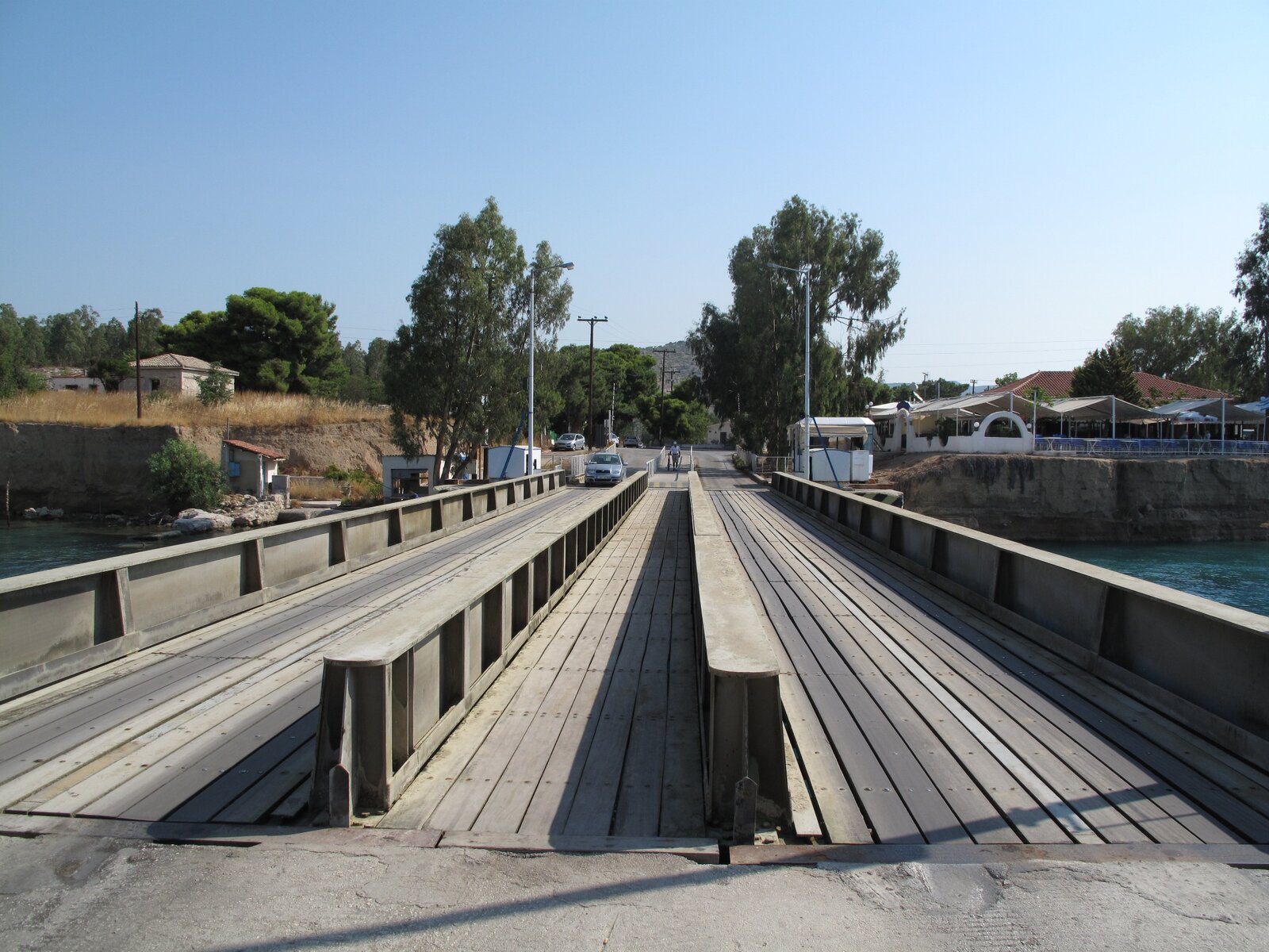
This is the part we send people to when they ask for something free and genuinely odd. At each end of the canal, a road bridge crosses at sea level — Posidonia on the western side, built in 1985, and Isthmia on the eastern side, built in 1987. When a ship comes, the bridge does not lift or swing. It sinks.
AEDIK’s technical services page gives the mechanics: each span is 33 metres long and 7 metres wide, carries two lanes, and is restricted to private cars, with a maximum uniform load of 300 kilograms per square metre. The deck descends at four metres a minute, and the authority says a full sinking or refloating cycle takes about three and a half minutes. Do that arithmetic and the deck travels something like fourteen metres in a cycle, which tells you how far below the keels of passing ships it has to end up. The policy is to sink a bridge only when a vessel is actually transiting, and the procedure starts 15 minutes before the ship arrives.
The catch for visitors: there is no published timetable. Sinkings follow ship movements, so you either arrive, see cars stopped at the barrier and get lucky, or you wait. Locals treat it as ordinary traffic — the Posidonia bridge in particular is the daily shortcut between the two towns. And, like anything mechanical, it fails occasionally. On the evening of 4 August 2026 the Isthmia bridge stopped mid-cycle with a winch motor fault, which the authority attributed to voltage fluctuation and expected to fix the next day. That is one evening out of a year, but it is the reason we tell guests to keep the bridge as a bonus rather than the centrepiece of an outing.
Before the canal: the Diolkos, and Nero’s four months
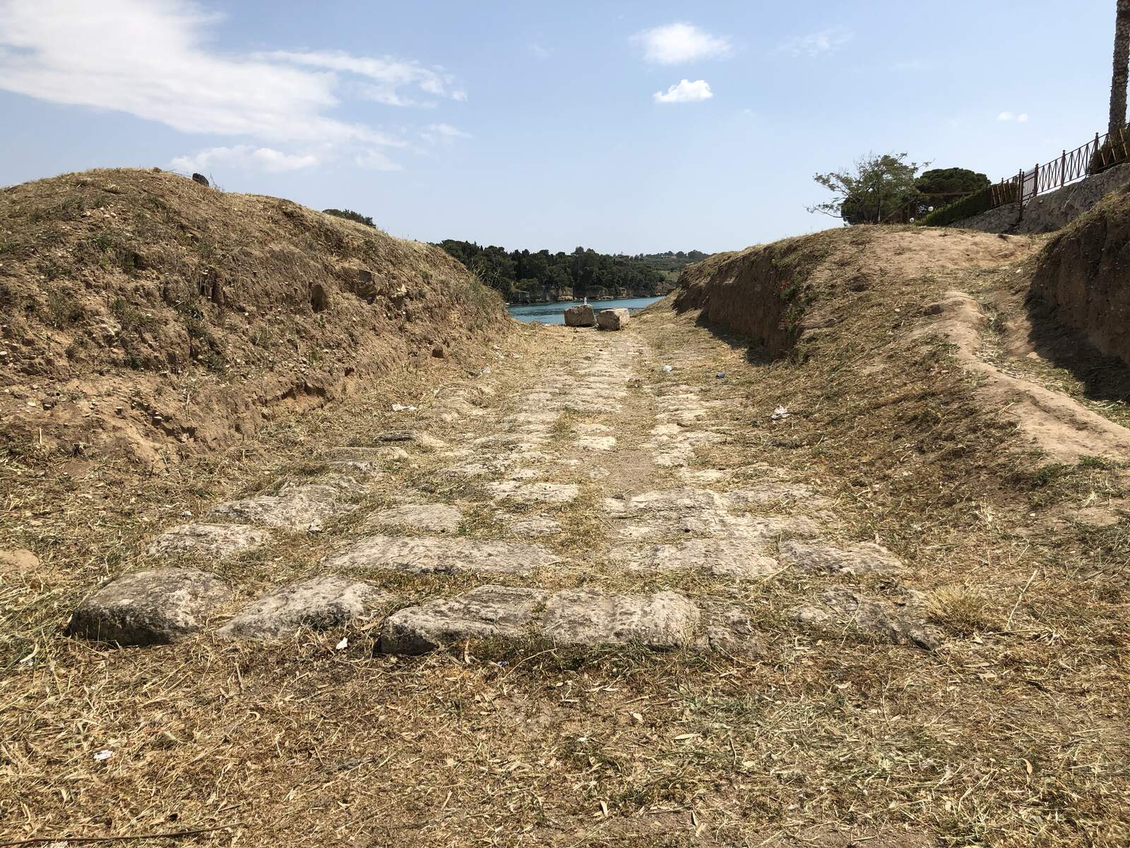
The idea of cutting the isthmus is old enough to be a joke about Greek infrastructure. The tyrant Periander is said to have considered a canal around 602 BC and built a paved haulway instead. That road, the Diolkos, is the more interesting story, because it worked.
The Ministry of Culture’s description puts its construction in the 6th century BC and records the excavated western section as 255 metres on the Peloponnese side and 204 metres on the mainland side, with a paved width between 3.40 and 6.00 metres and two grooves cut about 1.50 metres apart to guide the wheeled cradles. Small boats, mostly warships, were hauled across on it — and it stayed in use, on and off, into the 9th century AD. Fifteen centuries of service is a better record than the canal has managed so far.
Nero is the other name attached to the isthmus. He broke ground personally in 67 AD with a workforce that included six thousand Judean prisoners of war, and the project died with him the same year. Nobody finished the job until 1882, when a concession company under the Hungarian entrepreneur István Türr began work, went bankrupt around 1889, and handed the unfinished trench to a Greek company that completed it. The opening ceremony was held on 25 July 1893 in the Julian calendar Greece then used, which is 6 August 1893 by ours — which is why sources quote both dates for the same afternoon.
The Diolkos remains sit on the Posidonia side. Ship wash had been eroding the site for decades; shoring and edging work in October 2024 added gravel walkways designed to keep feet off the ancient blocks, and the footpath alongside was reported open again by mid-2025. Stay on the gravel. The grooves are the whole point of the monument.
Landslides, war, and why the walls keep failing
The canal’s problem has never been engineering ambition. It is the rock. Between 1893 and 1940 the canal was shut for four years in total for landslide repairs, and the worst single collapse, in 1923, dropped 41,000 cubic metres into the channel and closed it for two years. In October 1944 retreating German forces triggered slides deliberately and dumped locomotives and bridge wreckage into the cut; AEDIK puts that fall at 60,000 cubic metres and the clearance work at five years, with the US Army Corps of Engineers starting the excavation in November 1947.
Read the 2021–2026 closures against that record and they look less like mismanagement than the same slopes doing the same thing, which is also why the current works are described as slope stabilisation rather than dredging.
Seeing it from the water
Several operators run short cruises and glass-bottom trips through or along the canal from Isthmia, with advertised prices roughly in the €25–€45 range per adult. We aren’t naming one as the recommendation, because we could not verify any of their current schedules or prices from the operators’ own pages while writing this, and a boat trip you can’t book is worse than no suggestion at all. If a canal transit by boat matters to you, ask our concierge and we will check what is actually running that week.
Getting there from Loutraki
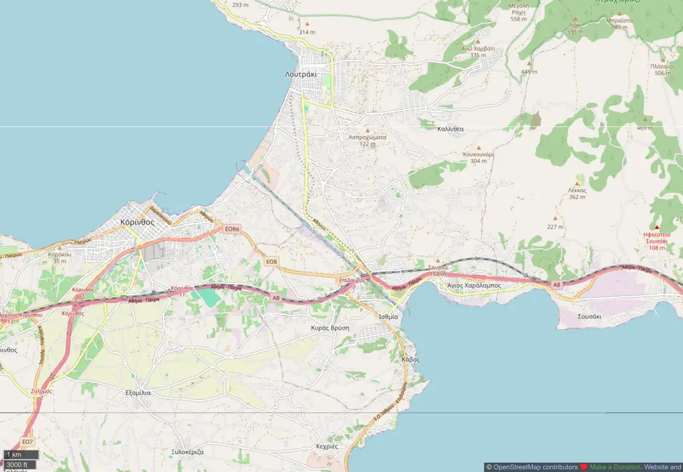
Everything above is a short drive. Isthmia and its submersible bridge are roughly six to seven kilometres from central Loutraki, about ten minutes; the old road bridge viewpoint is closer to six. We give those as approximate on purpose — the figures circulating online come from routing aggregators rather than any official measurement, and we would rather round honestly than publish false precision.
There is no useful bus for this. A taxi works, and a car works better, because the Diolkos and the two bridge ends sit on opposite sides of the canal and stitching them together on foot is not realistic in summer heat. If you are driving down from Athens first, our Athens to Loutraki guide covers the route, the tolls and the airport run.
Timing: mid-morning and late afternoon are kinder than midday, both for light down in the cut and for the coach parties that stop at the bridge on the Athens–Mycenae circuit. There is no shade at the viewpoint.
Twenty minutes further on, the archaeological site that the canal was built to serve still stands: our guide to Ancient Corinth and the free fortress of Acrocorinth covers tickets, hours and the drive.
Base yourself in Loutraki
The canal is one of the reasons Loutraki works as a base: it is close enough to visit on an evening whim rather than a planned excursion. The hilltop Villa Elena, with its pool and lit tennis court, takes groups large enough for a wedding or a family reunion, and the beachfront Villa Aura puts you on the seafront at Skaloma. Send an enquiry and we will help you sequence the canal with the rest of the area.
Cover photograph: “Vessel tugged through Corinth canal” by FocalPoint, CC BY-SA 3.0, via Wikimedia Commons. Canal specifications, bridge mechanics and operational status were taken from AEDIK (Corinth Canal S.A.) and checked on 29 August 2026; the Diolkos description is from the Greek Ministry of Culture. Bungee prices come from an archived November 2024 copy of the operator’s own price list, since the live site blocks automated requests, and should be confirmed with the operator. Navigation status can change with little notice.
Frequently asked questions
Is the Corinth Canal open in 2026?
Yes. AEDIK, the canal authority, announced on 17 June 2026 that the canal is open to navigation again, following the main phase of slope stabilisation works after the closures that began with the January 2021 landslide. Because the canal has reopened and reclosed several times since 2021, check the authority’s news page shortly before you travel. Viewing the canal from the road bridge does not depend on shipping status.
How wide and deep is the Corinth Canal?
AEDIK’s specifications give 24.60 metres of width at the water surface, 21 metres at the bottom, and 8 metres of depth, over a length of 6,343 metres, with 52 metres of clearance under the bridges. Those dimensions are why the canal takes small coasters, yachts and narrow cruise ships rather than modern container vessels, usually under tow.
Can you watch the submersible bridge at Isthmia go down?
Yes, and it costs nothing, but there is no timetable. The bridges sink only when a ship is transiting, starting about 15 minutes before it arrives, and the deck descends at four metres a minute with a cycle of roughly three and a half minutes. Treat it as a bonus if you happen to be at Isthmia or Posidonia when the barriers come down rather than a scheduled attraction.
How far is the Corinth Canal from Loutraki?
Roughly six to seven kilometres, or about ten minutes by car to Isthmia at the eastern end. Public transport is not practical for the canal itself, so plan on a car or a taxi, particularly if you also want to see the Diolkos remains on the Posidonia side.
What is the Diolkos?
A paved trackway built in the 6th century BC to haul boats overland across the isthmus, which the Greek Ministry of Culture records as 3.40 to 6.00 metres wide with two guide grooves about 1.50 metres apart. It remained in use into the 9th century AD. The excavated section sits near Posidonia at the canal’s western end, with gravel walkways added in 2024 to keep visitors off the ancient stones.
